Professional Observation
Basic Information
Observation Details
Observation Date:
January 9, 2026Submitted:
January 10, 2026Observer:
TAC - Charlie HarrisonZone or Region:
Taos AreaLocation:
Taos Ski Valley AreaSigns of Unstable Snow
Recent Avalanches?
YesCracking?
WidespreadCollapsing?
WidespreadSnow Stability
Stability Rating:
PoorConfidence in Rating:
Stability Trend:
Bottom Line
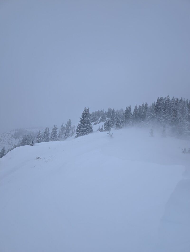
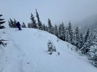
The first real snowstorms to roll through New Mexico in 2026 have added a slab on top a very weak snowpack that mainly consisted of faceted snow grains and depth hoar until today. In areas more affected by the wind, we were finding a more cohesive slab that was capable of propagating collapses in the facet layers over longer distances, and in several cases this led to persistent slab avalanches. In steep areas that were more sheltered from the winds, the new snow was generally less cohesive but would sluff downhill pretty easily and gouge into the cohesionless facets underneath. Cracking and collapsing was happening everywhere in the more wind-exposed areas, but not so much in sheltered areas.
Media
Advanced Information
Weather Summary
Cloud Cover:
ObscuredTemperature:
13-20Wind:
Moderate , ESnowfall came in short but strong pulses and also appeared to be occurring at different elevation bands throughout the day. About 1-3 inches fell in our zone between 8am and sundown. Winds were also somewhat variable, but definitely blowing at moderate speeds near ridge lines and transporting plenty of the new snow. Temps hung out in the teens throughout the day.
Avalanche Observations
| # | Date | Location | Size | Type | Bed Sfc | Depth | Trigger | Comments | Photo |
|---|---|---|---|---|---|---|---|---|---|
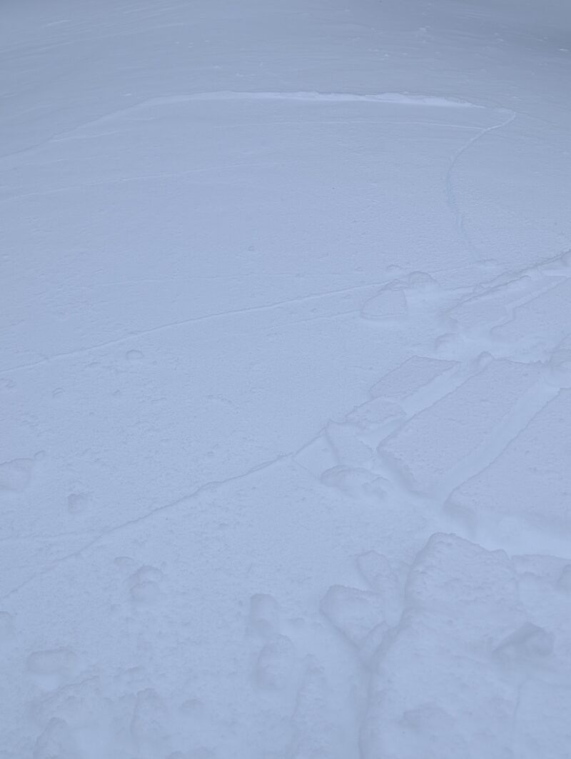
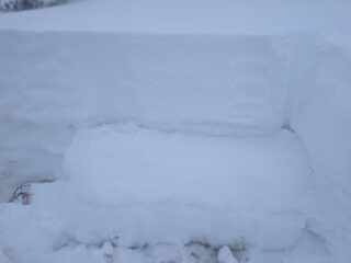
| 1 | Today |
Top of the World N 11,600 |
D1.5 | SS | O-Old Snow | 35cm |
AS-Skier c-Intentional |
This avalanche was triggered quite easily from above the start zone, and ran about 200 feet into the flats shortly beneath it. It occurred in below treeline terrain that is more open and exposed to the wind. The avalanche paints a pretty simple picture of what would be likely to happen in larger, more exposed terrain. |
|
In addition to the avalanche we triggered today, we heard many reports from mitigation teams of small slab avalanches pulling in below and near treeline terrain, as well as many dry loose sluffs running over significant distances. And though we didn't get any visibility to higher elevation terrain, we heard a few reports of natural slab avalanches failing in wind-exposed terrain above treeline.
Snowpack Observations
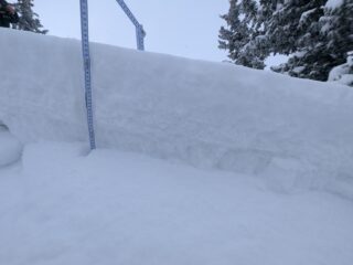
Today we dug on a cross-loaded North aspect near treeline. The snowpack depth was 85cm and we achieved very easy results: CT1 and ECTP2, both failing below the surface of the old snow in the faceted grains from early December. These results fall right in line with the conditions we're seeing out there, making it clear just how easy it can be to get large propagations wherever the new slabs have gained enough cohesion.
Avalanche Problems
| Problem | Location | Distribution | Sensitivity | Size | Comments |
|---|---|---|---|---|---|
 Persistent Slab
|
|
Layer Depth/Date: 25-50cm below the surface |
|||
 Dry Loose
|
|
Layer Depth/Date: Jan. 8-9 storm snow |