Professional Observation
Basic Information
Observation Details
Observation Date:
February 14, 2025Submitted:
February 15, 2025Observer:
TAC - Charles HarrisonZone or Region:
Taos AreaLocation:
Heavy Snow & Wind Creating Dangerous ConditionsSigns of Unstable Snow
Recent Avalanches?
YesCracking?
WidespreadCollapsing?
WidespreadSnow Stability
Stability Rating:
Very PoorConfidence in Rating:
HighStability Trend:
WorseningBottom Line
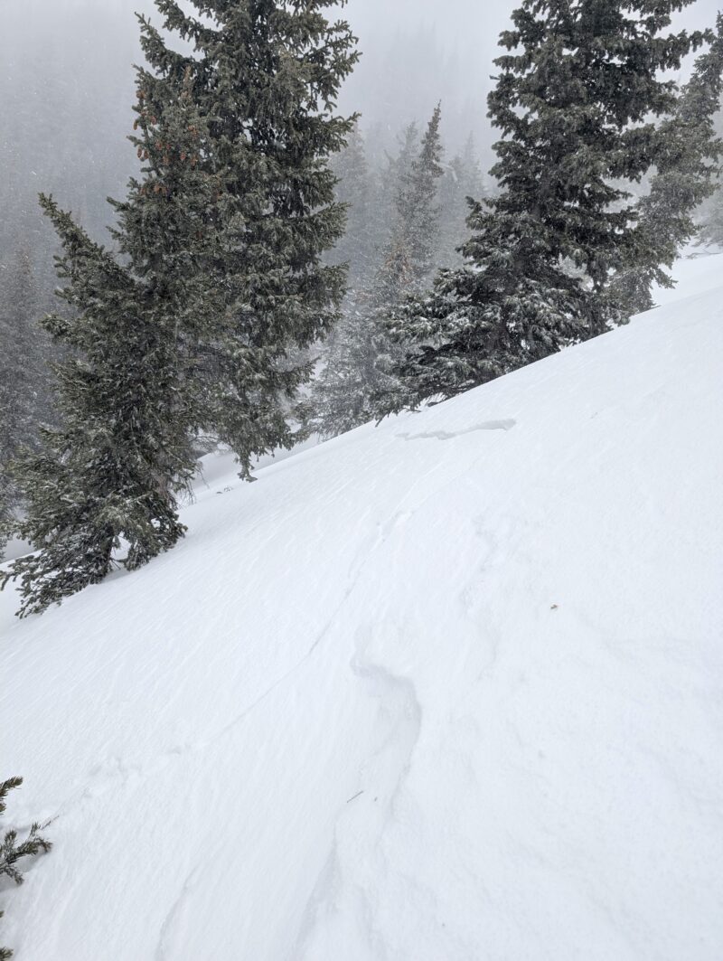
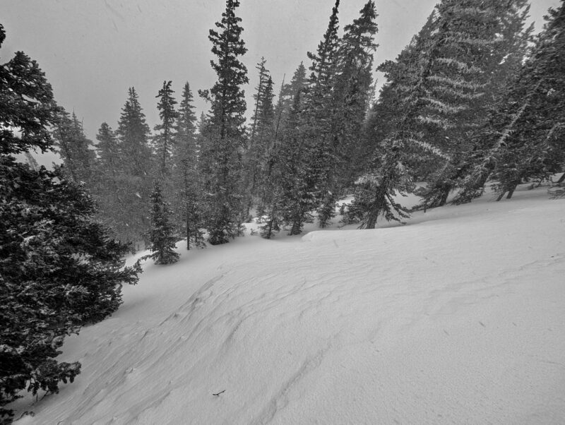
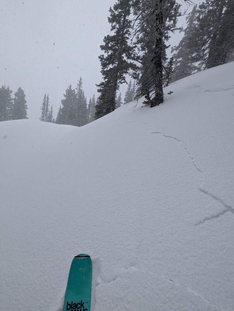
Today's winter storm has proven to be very wet and windy so far, and this is driving widespread patterns of instability in the snowpack. Fresh slabs of snow were actively forming and we got lots of easy collapses and shooting cracks in our travels, some of which occurred over wide areas 100 or more feet wide. There is a lot I could say about the developing conditions but here are 2 most important take home points, in my view:
1. This storm is dropping a significant amount of weight (though not necessarily a massive height of new snow) on an incredibly weak snowpack and is driving an increased possibility of large and dangerous persistent slab avalanches.
2. This storm is creating some notable spatial variability in slab development because it came in with so much wind -- thinner or scoured terrain was often adjacent to terrain holding a cohesive, reactive slab. This was very noticeable today, even below treeline and a good distance away from ridgelines. If this pattern continues, instability will become increasingly variable from slope to slope over the next several days.
Media
Advanced Information
Weather Summary
Cloud Cover:
ObscuredTemperature:
22-25Wind:
Strong , SWWe made it out during a more intense period of the storm and withstood many moments of blizzarding weather. Intense snowfall rates, 50-60mph wind gusts, and very poor visibility pretty much all in below treeline terrain. The new snow was up to 8 inches deep in places and shallower in many, but quite spatially variable from place to place thanks to the intense, swirling winds.
Avalanche Observations
| # | Date | Location | Size | Type | Bed Sfc | Depth | Trigger | Comments | Photo |
|---|---|---|---|---|---|---|---|---|---|
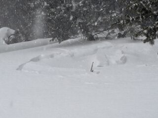
| 1 | Today |
N 11,500ft |
D1 | SS | O-Old Snow | 20cm |
AS-Skier r-Remote |
I triggered this small avalanche from about 100 feet away, and I suspect that it propagated on depth hoar. The avalanche was small but was able to release on stubborn-angled terrain and run 50 to 75 feet into flatter terrain below. |
|
It was difficult to see far and wide today for obvious reasons, but we still saw evidence of several natural avalanches that likely occurred at some point during today's storm, in addition to the one I was able to trigger.
Snowpack Observations
The snowpack in this entire region is incredibly weak, containing multiple failure points for an avalanche with fresh slabs building on the surface.
We noticed a lot of graupel falling during our time in the field, as well as sitting lower down in the new snow. Storm slab avalanches could fail on layers of graupel or other density changes throughout this storm and for a day or so afterwards. Alternatively, storm slab avalanches could fail on near surface facets at the old snow interface, a layer that is fairly widespread in the below treeline northerly terrain that held snow prior to this storm (we were in this kind of terrain today).
But the big takeaway from today's storm is that it's adding a significant amount of weight to our widespread depth hoar and faceted weak snow below the old snow surface. This is happening most dramatically at upper elevations, where higher winds and heavier snowfall were going on, but unfortunately we couldn't get a good look at much of that terrain today. However, some of our collapses today (and likely the avalanche I triggered) occurred on depth hoar, demonstrating that these widespread persistent weak layers are struggling to handle the weight of this loading event. We may not see the same snow totals as the January 30th storm, but this one is shaping up to add over twice as much water weight to the snowpack, and that's the sticking point. As soon as we get more visibility, I expect to see a wider incidence of large natural avalanches from this storm.