Professional Observation
Basic Information
Observation Details
Observation Date:
January 26, 2024 - January 26, 2024Submitted:
January 27, 2024Observer:
TAC - Charles HarrisonZone or Region:
Taos AreaLocation:
Williams Lake THSigns of Unstable Snow
Recent Avalanches?
None ObservedCracking?
None ExperiencedCollapsing?
IsolatedSnow Stability
Stability Rating:
FairConfidence in Rating:
HighStability Trend:
SteadyBottom Line
Today was a solid confirmation that the snowpack in our area continues to exhibit a strong-over-weak structure. The weak layers that developed over the early season months before Jan. 4th are continuing to facet and were prominent in all spots where we looked today. The slabs on top are fairly large (1-4ft) and continuing to harden, which also means that avalanches are a little bit more difficult to trigger. That being said, we did collapse the weak layers in a couple of shallower spots on the margins of slabs that we crossed or were near. Keep this last piece of information in mind as you travel around the mountains, because these trigger points are where you're most likely to trigger an avalanche and they are definitely out there.
Media
Advanced Information
Weather Summary
Cloud Cover:
OvercastTemperature:
15-20Wind:
Light , NETemperatures were moderate where we toured today, mostly in the high teens. The snow was falling lightly for most of the day (S1) with a few moments of slightly more intense precipitation and a little bit of graupel around 1pm. Winds were light all day with a few moderate gusts in the mix. There wasn't much active wind transport going on in our area even though it is a highly wind-affected area, and as a result we didn't see any wind slabs forming in the upper snowpack.
Snowpack Observations
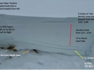
We dug a profile at 11,600' on a West facing gully and got the following results:
HS 90-125cm
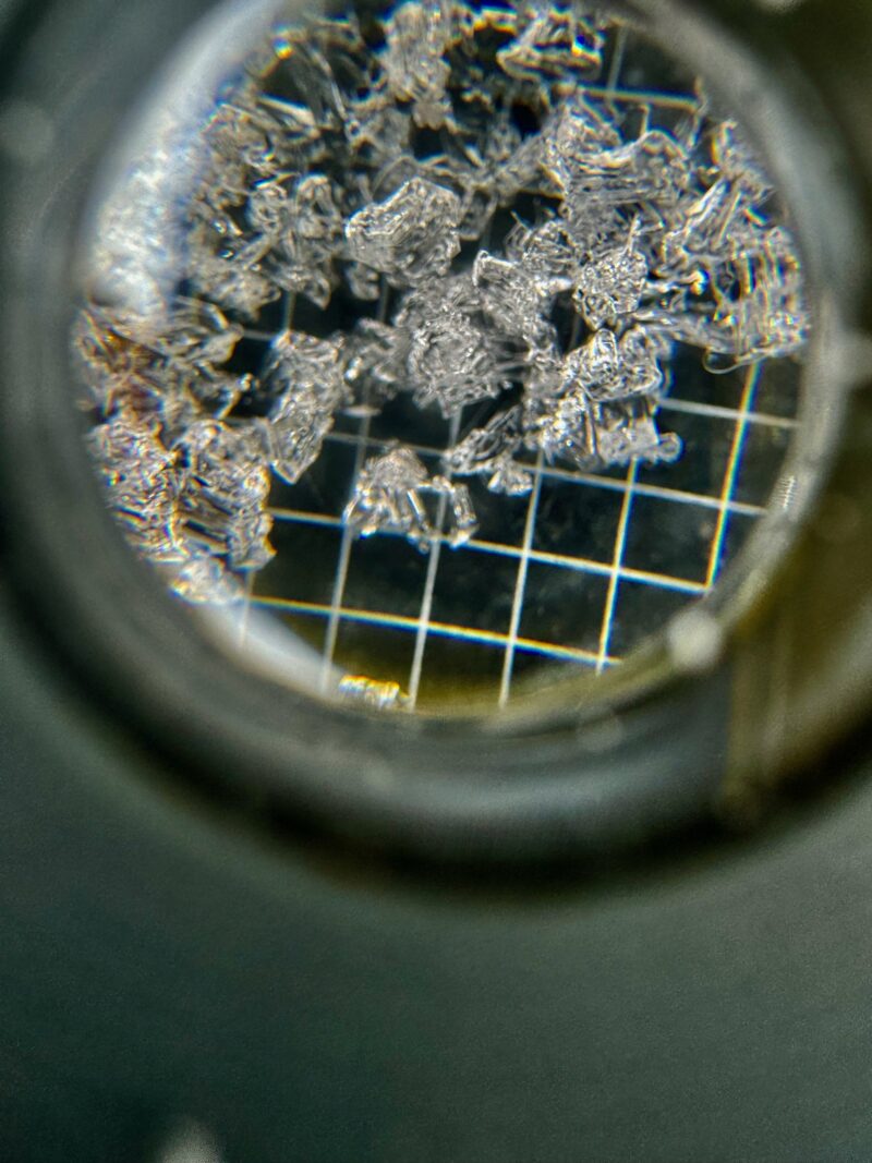
CT26 on 1-2mm facets (December draught layer)
ECTP 23 on the same weak layer
PST 35/150 END on the December layer
I'll also note that we found large depth hoar in this snowpit and found the location to be a good example of how the slab thickness/weak layer depth can taper rapidly over a short amount of space. Look at the photo and consider that it will likely be easier to collapse the December layer or the depth hoar on the left side of our slab versus the right.
Avalanche Problems
The persistent slab problem is alive and well, albeit more stubborn than it was a week ago. I expect the avalanche hazard to rise if we see enough warming in the next few days, and certainly if the storm that's coming our way towards the end of next week adds a significant load to this snowpack.
Close