Basic Information
Observation Details
Observation Date:
February 25, 2022Submitted:
February 26, 2022Observer:
TAC - Andy BondZone or Region:
Taos AreaLocation:
Williams Lake AreaSigns of Unstable Snow
Recent Avalanches?
YesCracking?
IsolatedCollapsing?
IsolatedBottom Line
Dangerous avalanche conditions continue to exist as weak layers will need time to adjust to the latest load. Recent avalanches and bulls-eye clues like loud collapses and shooting cracks and continued moderate to strong winds are going to keep the avalanche danger at considerable for some time.
Advanced Information
Weather Summary
Cloud Cover:
Mostly SunnyTemperature:
5 - 25Wind:
Moderate , SWBeautiful sunny day with light winds below treeline and 10 - 20 mph sw winds at higher elevations with gusts in the 30's. Snow was drifting at upper elevations but much of the snow available for transport in the fetches on the windward slopes has been stripped.
Avalanche Observations
| # | Date | Location | Size | Type | Bed Sfc | Depth | Trigger | Comments | Photo |
|---|---|---|---|---|---|---|---|---|---|
| 1 | Past 48 hours |
Lake Fork Ridgeline E 12,400 |
D2 | SS | N-Natural |

|
|||
| 1 | Past 48 hours |
Kachina Peak |
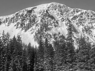
D2 | SS | N-Natural | Natural avalanches on East and NE aspects on Kachina Peak that ran in almost the identical place from when they slid during the January 1st storm. |

|
||
| 1 | Past 48 hours |
Blake Fork Ridgeline NE |
D2 | SS | N-Natural |

|
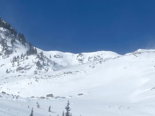
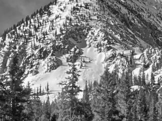
Avalanches were observed at all elevations with the majority happening Near and Above Treeline on North through East aspects where we've seen the most amount of loading.
Snowpack Observations
The snowpack was less sensitive today but was getting isolated collapses on wind drifted slopes on northerly and east aspects near treeline. I was finding slabs of varying thickness as winds have drifted snow into 2 + feet thick slabs on some slopes while others have been stripped back to the old surface as inverted tracks prior to the storm were visible.
Below treeline, I was finding a poor snowpack structure of strong over weak on north and east aspects and was getting isolated slopes to collapse but nothing was moving on steep test slopes.
Avalanche Problems
| Problem | Location | Distribution | Sensitivity | Size | Comments |
|---|---|---|---|---|---|
 Persistent Slab
|
|
||||
 Wind Slab
|
|
