Professional Observation
Basic Information
Observation Details
Observation Date:
December 22, 2020Submitted:
December 22, 2020Observer:
TAC - Andy BondZone or Region:
Taos AreaLocation:
Williams Lake AreaSigns of Unstable Snow
Recent Avalanches?
YesCracking?
IsolatedCollapsing?
IsolatedSnow Stability
Stability Rating:
GoodConfidence in Rating:
ModerateStability Trend:
SteadyMedia
Advanced Information
Weather Summary
Cloud Cover:
Partly CloudyTemperature:
25 - 30Wind:
Light , WWinds were moderate at ridgetop blowing in the 20's gusting up to 40 mph out of the SW. No snow was transporting
Avalanche Observations
| # | Date | Location | Size | Type | Bed Sfc | Depth | Trigger | Comments | Photo |
|---|---|---|---|---|---|---|---|---|---|
| 1 | Past 24 hours |
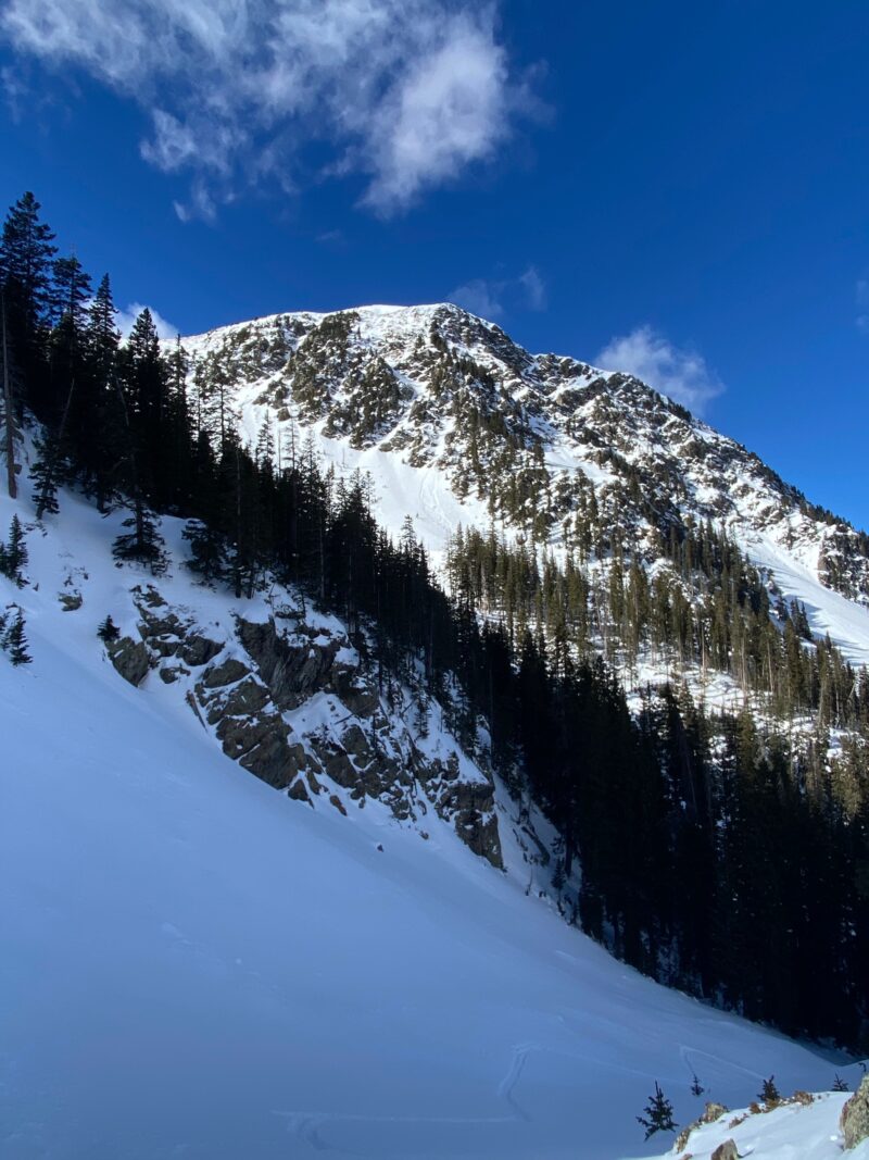
Ring Finger Area W 11,400 |
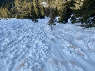
D1 | WL | G-Ground | N-Natural | What most likely started out as a small wet loose sometime yesterday afternoon 12/21 with warm temperatures and sun was able to gauge to the ground entraining the weak shallow overall snowpack. |
|
We did observe some other small loose snow avalanches just below cliffs on solar aspects.
Snowpack Observations
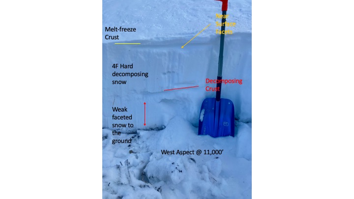
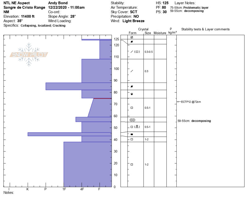
We continue to find an overall shallow snowpack that is quickly faceting in the top 20 cm near the surface. South and West aspects had melt-freeze crusts from yesterday's sunny warm day. The week-plus of high pressure we've had is decomposing slabs that formed from the December 10-12th storms.
The recent avalanche that most likely occured on 12/21 in the afternoon with warming and sun is a great example of how weak our snowpack is on some slopes. A small point release was easily able to entrain snow to the ground. As we wait for our next storm which may be a week a way, it could be an indication of things to come as we have not been able to add depth to our snowpack since the middle of December.
We did get localized collapsing and cracking on NE aspects near treeline on slopes that had not pulled naturally during the December 11th avalanche cycle. The weak layer of concern is buried facets beneath a hard wind slab that formed in early December with last weeks storm snow on top. We continue to get this weak layer to collapse and propagate with moderate force.
Our snowpack is highly variable as both the adjacent slopes next to this one had avalanched during the widespread natural avalanche cycle we had last weekend. On these slopes the snowpack is shallow and faceted beneath the old bed surface.