Professional Observation
Basic Information
Observation Details
Observation Date:
December 18, 2020 - December 18, 2020Submitted:
December 18, 2020Observer:
TAC - Steve GatelyZone or Region:
Taos AreaLocation:
Bull of the WoodsSigns of Unstable Snow
Recent Avalanches?
None ObservedCracking?
IsolatedCollapsing?
IsolatedSnow Stability
Stability Rating:
FairConfidence in Rating:
ModerateStability Trend:
SteadyBottom Line
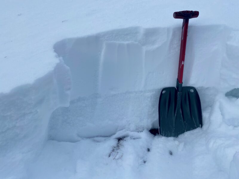
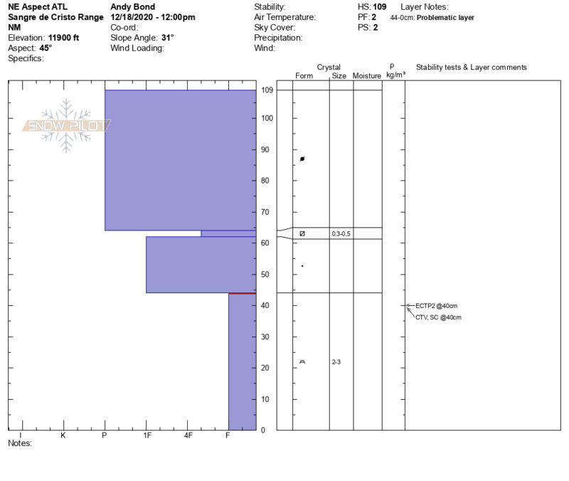
Moderate to strong winds over the last 48hrs have stiffened slabs mainly on North through East aspects above tree line. We were finding 2 to 3 foot pencil hard slabs over weak snow, in part due to wind deposition. This exact structure was not widespread but evidence of stiffening slabs from strong winds was widespread. Slab stiffening was also observed near tree line as well, just not as substantial. Below tree line much of the snowpack is faceting again and is on it's way towards becoming cohesion-less given enough time. The one exception here is the upper end of below tree line terrain. You can still find areas, typically in open terrain, that have enough of a slab present to still collapse underfoot and present a concern for avalanches.
Media
Advanced Information
Weather Summary
Cloud Cover:
Mostly CloudyTemperature:
14Wind:
Moderate , WCold day out there today with temperatures 10 degrees or more below where they were 24hrs ago. Wind was blowing moderately out of the West. Where we traveled we didn't observe wind actively transporting snow - however, we saw plenty of evidence of where it did over the previous 24hrs.
Snowpack Observations
Hard slabs are forming on our above tree line terrain from strong Westerly winds over the past 48hrs. Shallower snowpack's that can be found both near and below tree line have softer slabs that are deteriorating, especially in wind sheltered areas. Depth Hoar is the main layer of concern here. In deeper snowpack's near and above tree line you can find a layer of near surface facets buried just under our most recent storm snow.
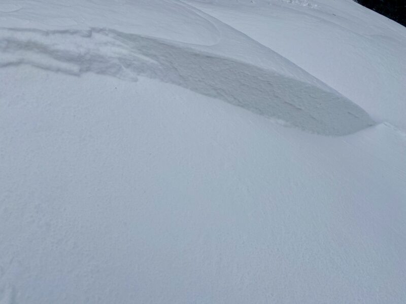
Small pockets of isolated wind slab have formed on the leeward sides of ridgelines and gullies. These avalanches if triggered would be small. The more likely scenario is that areas of heavy wind loading would fail on facets creating a larger persistent slab avalanche.

Avalanche Problems
| Problem | Location | Distribution | Sensitivity | Size | Comments |
|---|---|---|---|---|---|
 Persistent Slab
|
|
Terrain Use
We surveyed almost all of our terrain from the safety of the ridgeline today.
Close