Professional Observation
Basic Information
Observation Details
Observation Date:
November 25, 2020Submitted:
November 25, 2020Observer:
TAC - Steve GatelyZone or Region:
Taos AreaLocation:
No Name Cirque to Lake ForkSigns of Unstable Snow
Recent Avalanches?
YesCracking?
IsolatedCollapsing?
IsolatedSnow Stability
Stability Rating:
PoorConfidence in Rating:
HighStability Trend:
SteadyBottom Line
WIND SLAB:
We encountered small pockets of wind slabs just on the leeward sides of ridges at upper elevations. These wind slabs were stubborn to trigger and ran very sluggishly.
PERSISTENT SLAB:
The bottom line here is that finding the appropriate structure to trigger one of these avalanches takes some digging. We've found it on generally all polar aspects but we were surprised to be traveling on upper elevation East facing terrain and finding storm snow from the previous 48hrs with little to no old snow to speak of underneath it. Then one drainage over finding the structure to produce a persistent slab avalanche on the same aspect and elevation. The areas where we are finding a cohesive slab are areas with signs of wind transport. Due to the massive amount of spatial variability the only way to identify this structure is to look for it.
Media
Advanced Information
Weather Summary
Cloud Cover:
ClearTemperature:
25-28Wind:
Moderate , WSkies were clear and we experienced light up valley winds at and below tree line starting at about Williams Lake. Ridgetops saw West winds averaging 15mph with gusts around 25. Wind transported snow could easily be spotted from down in the valley. Solar aspects at and below tree line were taking heat by around midday and we saw fairly significant sun effect by late afternoon.
Avalanche Observations
| # | Date | Location | Size | Type | Bed Sfc | Depth | Trigger | Comments | Photo |
|---|---|---|---|---|---|---|---|---|---|
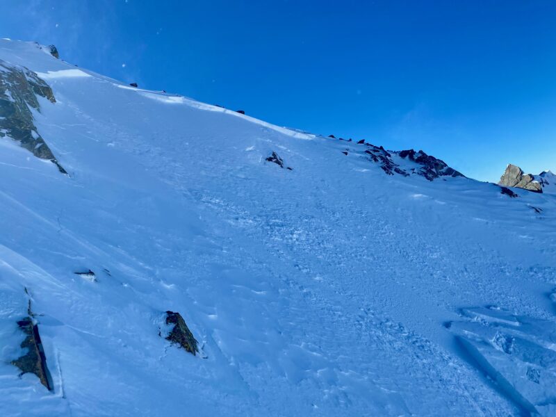
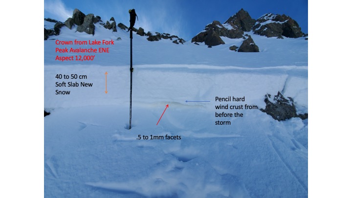
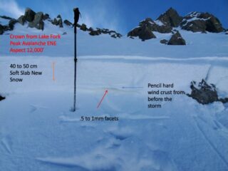
| 1 | Today |
Lake Fork E 12,000 |
D1.5 | SS | O-Old Snow | 14-16" |
AS-Skier c-Intentional |
This avalanche failed on near surface facets that formed prior to 11/23-24 storm. These facets stayed well preserved underneath a firm but thin layer of wind skin. |
|
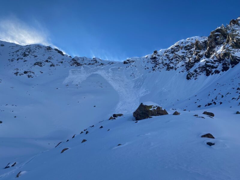
| 2 | Past 24 hours |
Vallecito N 11,400-11,700ft |
D1 | SS | O-Old Snow | N-Natural | We observed several natural avalanches that occurred during the 11/23-24 storm directly underneath large cliff bands on North facing terrain on Vallecito. We presume that these avalanches failed on the near surface facets formed prior to 11/23. They likely went natural due to the additional loading providing by snow sloughing down cliff bands and settling underneath. | None | |
| 3 | Past 24 hours |
Backside Kachina Peak E 11,200ft |
D1 | SS | N-Natural | We did not get a chance to take a closer look at this avalanche but it appeared to fail within the new snow likely on graupel that fell at the onset of precipitation 11/23. |
|
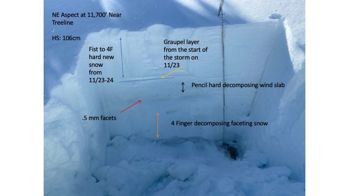
Snowpack Observations
The three key ingredients we need for producing an avalanche right now is...
-Added Weight from wind transported snow
-A Cohesive Slab (created from wind transport)
-An existing snowpack prior to 11/23-24 storm
We are predominately finding this structure on Northwest through East facing terrain at and above tree line.
Avalanche Problems
| Problem | Location | Distribution | Sensitivity | Size | Comments |
|---|---|---|---|---|---|
 Persistent Slab
|
|
||||
 Wind Slab
|
|