Professional Observation
Basic Information
Observation Details
Observation Date:
January 9, 2026Submitted:
January 10, 2026Observer:
TAC - JasperZone or Region:
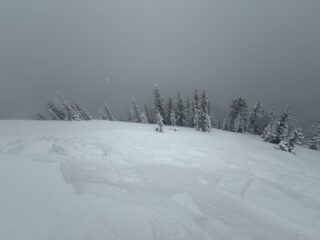
Sante Fe AreaLocation:
Big Tesuque, E-S-W aspects Below and Near Treeline 11200-12000ftSigns of Unstable Snow
Recent Avalanches?
YesCracking?
IsolatedCollapsing?
IsolatedSnow Stability
Stability Rating:
PoorConfidence in Rating:
ModerateStability Trend:
WorseningBottom Line
The first significant storm of the season has deposited a slab on top of a variable base including bare ground, facets and depth hoar. Now we have all the ingredients for avalanches. Facets and depth hoar will now make up a widespread persistent weak layer.
Advanced Information
Weather Summary
Cloud Cover:
OvercastWind:
Moderate , NWStormy morning with S2 snowfall, moderate NW winds at ridgeline and calm winds below treeline. Snow transport onto easterly slopes.
Avalanche Observations
| # | Date | Location | Size | Type | Bed Sfc | Depth | Trigger | Comments | Photo |
|---|---|---|---|---|---|---|---|---|---|
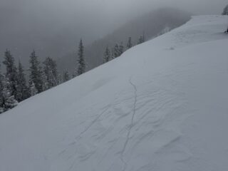
| 1 | Today |
Santa Fe River below Communication Towers E 12000 |
D1 | C | S-New Snow | 6 | N-Natural | Cornice failure |
|
Small cornice failure on east facing slope 12000ft
Snowpack Observations
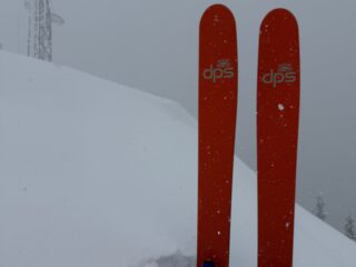
Around 11000 to 12000 feet snowpack now varies from 8" on solar aspects to over 3 feet in drifts, with the average being around 2 feet. Foot penetration is still nearly full depth. Ski penetration about 12 inches.
Avalanche Problems
Today Dry Loose and Cornice were seen. Structure exists for Persistent Slab.
Terrain Use
Avoided all avalanche terrain and solar slopes due to shallow snow, increasing avalanche hazard, and high uncertainty.
Close