Basic Information
Observation Details
Observation Date:
March 14, 2021Submitted:
March 14, 2021Observer:
TAC - Andy BondZone or Region:
Taos AreaLocation:
Storm SlabsSigns of Unstable Snow
Recent Avalanches?
YesCracking?
IsolatedCollapsing?
None ExperiencedMedia

Advanced Information
Weather Summary
Cloud Cover:
ObscuredTemperature:
8 - 23Wind:
Moderate , WWest winds were blowing in the high teens and 20's at ridgelines with gusts in the high 30's. Snow throughout the day and since 5 AM we've picked up an additional 8 to 10 inches of snow.
Snowpack Observations
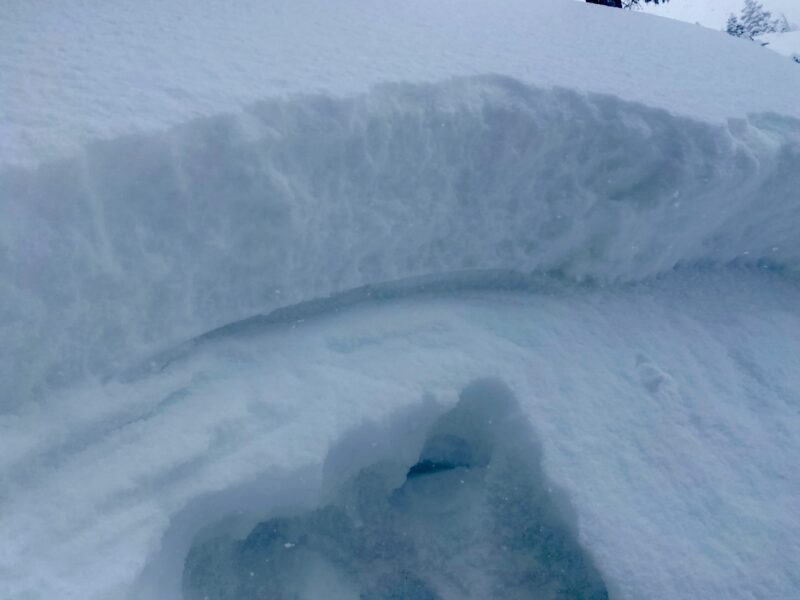
Snow totals as of 2 PM are anywhere from 16 to 22 inches with 1.5" of snow water equivalent measured at the snotel site. Snow was continuing to fall and should last through the evening. In travels today, we did trigger a small storm slab avalanche on a small convex test slope that failed on near-surface facets on a north aspect.
Visibility was not the greatest today, but we did observe a couple of natural avalanches mainly near and above treeline as well as a large debris pile far down in the runout of an avalanche path on the backside of Kachina Peak. Early this morning we had reports of natural avalanches running long distances well into the flats. With better visibility tomorrow hopefully we'll get a better extent of the avalanche activity from today.
Avalanche Problems
| Problem | Location | Distribution | Sensitivity | Size | Comments |
|---|---|---|---|---|---|
 Storm Slab
|
|
Storm slabs were getting stiffer near treeline and open exposed areas below treeline from the moderate winds today. Did not make up high, but would assume these slabs are more sensitive on the leeward sides of ridgelines and cross-loaded terrain features where the wind has gotten to it. |
Terrain Use
Kept it very mellow, with poor visibility and increased avalanche hazard.
Close